What’s happening / being planned?
Watlington Relief Road is a proposed new road through Watlington parish and neighbouring Pyrton parish in South Oxfordshire. The road would be partly funded by £7.1m from the Oxfordshire Housing and Growth Deal. Forward funding from the growth deal is conditional that it is clawed back from payments from house builders whose sites are unlocked by the infrastructure forward investment.
The relief road would form part of a new, more attractive strategic route for long distance traffic from the west going to and from the M40, including for HGVs and LGVs. It is expected to ease issues of congestion, noise and air quality in the village but increase traffic along the route. Bus services would continue to serve Watlington high street.
Land for a bypass at Watlington is safeguarded for a “strategic” transport scheme in the current South Oxfordshire Local Plan, justified by the strategic allocation for 3000 houses at Chalgrove Airfield. This is now proposed to be deallocated from the plan. Some sections would take traffic through new housing estates and would be built by house developers. These have planning permission with access roads and are not dependent on the county council completing a relief road. To build its sections, the Council requires more housing development (to that already approved).
The scheme would include the construction of 1.4km of road, two roundabouts, a school coach drop off and a new crossing of the Chalgrove Brook, chalk stream.
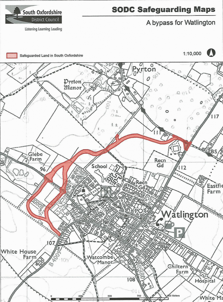
Map of the safeguarded land

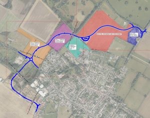
Map showing road and proposed housing development sites

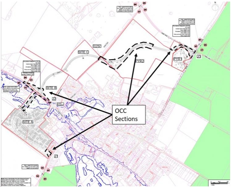
Map showing sections of road to be funded by Oxfordshire County Council

